One moment please, your device is loading the charts...
Population numbers in the municipality Euerdorf for the years 2009 thru 2019.
The number of inhabitants is the number of persons as registered in the population register on January 1st.
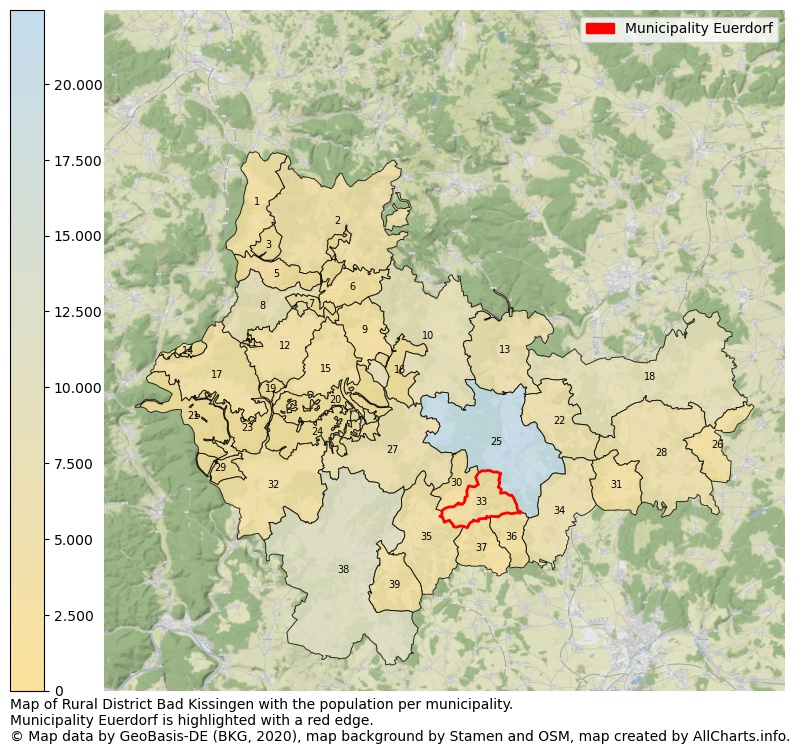
Map of Rural district Bad Kissingen with the population per municipality.Municipality Euerdorf is highlighted with a red edge. The numbers at the map represent the following municipalities: 1: municipality Motten, 2: municipality Wildflecken, 3: unincorporated area Mottener Forst-Süd, 4: unincorporated area Großer Auersberg, 5: unincorporated area Römershager Forst-Nord ...Show more... Map of Rural district Bad Kissingen with the population per municipality.Municipality Euerdorf is highlighted with a red edge. The numbers at the map represent the following municipalities: 1: municipality Motten, 2: municipality Wildflecken, 3: unincorporated area Mottener Forst-Süd, 4: unincorporated area Großer Auersberg, 5: unincorporated area Römershager Forst-Nord, 6: municipality Riedenberg, 7: unincorporated area Römershager Forst-Ost, 8: municipality city Bad Brückenau, 9: municipality Geroda, 10: municipality Burkardroth, 11: unincorporated area Dreistelzer Forst, 12: municipality Oberleichtersbach, 13: municipality Bad Bocklet, 14: unincorporated area Kälberberg, 15: municipality Schondra, 16: unincorporated area Waldfensterer Forst, 17: municipality Zeitlofs, 18: municipality city Münnerstadt, 19: unincorporated area Geiersnest-West, 20: unincorporated area Geiersnest-Ost, 21: unincorporated area Roßbacher Forst, 22: municipality Nüdlingen, 23: unincorporated area Forst Detter-Süd, 24: unincorporated area Neuwirtshauser Forst, 25: municipality city Bad Kissingen, 26: municipality Thundorf i. UFr., 27: municipality Oberthulba, 28: municipality Maßbach, 29: unincorporated area Omerz u. Roter Berg, 30: municipality Aura a.d. Saale, 31: municipality Rannungen, 32: municipality Wartmannsroth, 33: municipality Euerdorf, 34: municipality Oerlenbach, 35: municipality Elfershausen, 36: municipality Ramsthal, 37: municipality Sulzthal, 38: municipality city Hammelburg, 39: municipality Fuchsstadt ...Show less...
One moment please, your device is loading the charts...
Municipality Euerdorf, 2019, number of rooms per house.
The percentage shows the relative share of houses per category based on the numer of rooms: 1 to 2 rooms, 3 to 4 rooms or 5 rooms or more. This is based on the total number of rooms as identified for all dwellings in the municipality Euerdorf.
The table below shows data for more than 100 topics as most recently available for the municipality Euerdorf. Select a category to display the related topics:
| Business | Value | Unit | Year |
|---|---|---|---|
| Businesses | 3 | Number | 2017 |
| Active persons | 265 | Number | 2017 |
| Gross wages | €12.525 | Euro | 2017 |
| Dwellings | Value | Unit | Year |
|---|---|---|---|
| Houses 1 room | 5 | Number | 2019 |
| Houses 2 rooms | 22 | Number | 2019 |
| Houses 3 rooms | 124 | Number | 2019 |
| Houses 4 rooms | 195 | Number | 2019 |
| Houses 5 rooms | 169 | Number | 2019 |
| Houses 6 rooms | 108 | Number | 2019 |
| Houses 7+ rooms | 163 | Number | 2019 |
| Houses 1-2 rooms | 27 | Number | 2019 |
| Houses 3-4 rooms | 319 | Number | 2019 |
| Houses 5+ rooms | 440 | Number | 2019 |
| 1-2 rooms | 3% | Percentage | 2019 |
| 3-4 rooms | 41% | Percentage | 2019 |
| 5+ rooms | 56% | Percentage | 2019 |
| Elections | Value | Unit | Year |
|---|---|---|---|
| Voters Bundestag | 1208,00 | Number | 2017 |
| Voter turnout Bundestag | 80 | Number | 2017 |
| Votes valid Bundestag | 962 | Number | 2017 |
| Votes Bundestag CDU/CSU | 402 | Number | 2017 |
| Votes Bundestag SPD | 157 | Number | 2017 |
| Votes Bundestag GRÜNE | 74 | Number | 2017 |
| Votes Bundestag FDP | 97 | Number | 2017 |
| Votes Bundestag DIE LINKE | 55 | Number | 2017 |
| Votes Bundestag AfD | 103 | Number | 2017 |
| Votes Bundestag other parties | 74 | Number | 2017 |
| Votes Bundestag total | 962 | Number | 2017 |
| % Votes Bundestag CDU/CSU | 33% | Percentage | 2017 |
| % Votes Bundestag SPD | 13% | Percentage | 2017 |
| % Votes Bundestag GRÜNE | 6% | Percentage | 2017 |
| % Votes Bundestag FDP | 8% | Percentage | 2017 |
| % Votes Bundestag DIE LINKE | 5% | Percentage | 2017 |
| % Votes Bundestag AfD | 9% | Percentage | 2017 |
| % Votes Bundestag other parties | 6% | Percentage | 2017 |
| Employment | Value | Unit | Year |
|---|---|---|---|
| Employees | 586 | Number | 2019 |
| Employees male | 305 | Number | 2019 |
| Employees female | 281 | Number | 2019 |
| Employees foreigner | 23 | Number | 2019 |
| Employees male foreigner | 12 | Number | 2019 |
| Employees female foreigner | 11 | Number | 2019 |
| Unemployed | 27 | Number | 2018 |
| Unemployed foreigners | 2 | Number | 2018 |
| Unemployed severely disabled | 3 | Number | 2018 |
| Unemployed 15-20 | 0 | Number | 2018 |
| Unemployed 15-25 | 3 | Number | 2018 |
| Unemployed 55-65 | 10 | Number | 2018 |
| Unemployed long-term | 11 | Number | 2018 |
| % Unemployed | 2% | Percentage | 2018 |
| % Unemployed foreigners | 0% | Percentage of the population | 2018 |
| % Unemployed severely disabled | 0% | Percentage of the population | 2018 |
| % Unemployed 15-20 | 0% | Percentage of the population | 2018 |
| % Unemployed 15-25 | 0% | Percentage of the population | 2018 |
| % Unemployed 55-65 | 1% | Percentage of the population | 2018 |
| % Unemployed long-term | 1% | Percentage of the population | 2018 |
| Income | Value | Unit | Year |
|---|---|---|---|
| Income receivers | 749 | Number | 2015 |
| Income total | €28.498 | Euro | 2015 |
| Income tax | €5.045 | Euro | 2015 |
| Population | Value | Unit | Year |
|---|---|---|---|
| Population | 1.515 | Number | 2019 |
| Men | 751 | Number | 2019 |
| Women | 764 | Number | 2019 |
| % Men | 50% | Percentage | 2019 |
| % Women | 50% | Percentage | 2019 |
| 0-18 | 233 | Number | 2019 |
| 18-30 | 196 | Number | 2019 |
| 30-45 | 260 | Number | 2019 |
| 45-60 | 336 | Number | 2019 |
| 18-60 | 792 | Number | 2019 |
| 60-75 | 317 | Number | 2019 |
| 60+ | 490 | Number | 2019 |
| Average age | 46 | Average number | 2019 |
| Average age male | 45 | Average number | 2019 |
| Average age female | 46 | Average number | 2019 |
| Births | 12 | Number | 2018 |
| Births male | 6 | Number | 2018 |
| Births female | 6 | Number | 2018 |
| 1K Births | 8 | Number per 1000 inhabitants | 2018 |
| Deaths | 16 | Number | 2018 |
| Deaths male | 10 | Number | 2018 |
| Deaths female | 6 | Number | 2018 |
| 1K Deaths | 11 | Number | 2018 |
| 0-3 | 35 | Number | 2019 |
| Girls 0-3 | 14 | Number | 2019 |
| Boys 0-3 | 21 | Number | 2019 |
| 3-6 | 47 | Number | 2019 |
| Girls 3-6 | 15 | Number | 2019 |
| Boys 3-6 | 32 | Number | 2019 |
| 6-10 | 54 | Number | 2019 |
| 10-15 | 61 | Number | 2019 |
| 15-18 | 36 | Number | 2019 |
| 18-20 | 31 | Number | 2019 |
| 20-25 | 82 | Number | 2019 |
| 25-30 | 83 | Number | 2019 |
| 30-35 | 83 | Number | 2019 |
| 35-40 | 91 | Number | 2019 |
| 40-45 | 86 | Number | 2019 |
| 45-50 | 96 | Number | 2019 |
| 50-55 | 119 | Number | 2019 |
| 55-60 | 121 | Number | 2019 |
| 60-65 | 136 | Number | 2019 |
| 65-75 | 181 | Number | 2019 |
| Women 65-70 | 92 | Number | 2019 |
| Men 65-70 | 89 | Number | 2019 |
| 75+ | 173 | Number | 2019 |
| Women 75+ | 94 | Number | 2019 |
| Men 75+ | 79 | Number | 2019 |
| % 0-10 | 9% | Percentage | 2019 |
| % 10-18 | 6% | Percentage | 2019 |
| % 18-30 | 13% | Percentage | 2019 |
| % 30-45 | 17% | Percentage | 2019 |
| % 45-60 | 22% | Percentage | 2019 |
| % 60+ | 32% | Percentage | 2019 |
| Real estate | Value | Unit | Year |
|---|---|---|---|
| Property tax A revenue | no data | Euro | no data |
| Property tax B revenue | no data | Euro | no data |
| Trade tax actual revenue | no data | Euro | no data |
| Property tax A basic amount | no data | Euro | no data |
| Property tax B basic amount | no data | Euro | no data |
| Trade tax basic amount | no data | Euro | no data |
| Property tax A rate | no data | Euro | no data |
| Property tax B rate | no data | Euro | no data |
| Trade tax rate | no data | Euro | no data |
| Real tax raising force | no data | Euro | no data |
| Trade tax levy | no data | Euro | no data |
| Trade tax net | no data | Euro | no data |
| Community share in income tax | no data | Euro | no data |
| Community share in sales tax | no data | Euro | no data |
| Tax revenue | no data | Euro | no data |
| Regional | Value | Unit | Year |
|---|---|---|---|
| Region code | 096725608122 | Code | 2019 |
| Region code 8 digits | 09672122 | Code | 09672122 |
| Sorting code | 096725608122 | Code | 096725608122 |
| Sorting code 8 digits | 09672122 | Code | 09672122 |
| Region name | Euerdorf | Name | 2019 |
| Regional level | 6 | Categorical type | 2019 |
| Region type | Municipality | Categorical type | 2019 |
| Region type detail | municipality | Categorical type | 2019 |
| Region name with type | municipality Euerdorf | Name | 2019 |
| Region name in German | Gemeinde Euerdorf | Name | 2019 |
| Direct subregions | no data | Number | 2019 |
| NUTS code | DE265 | Code | 2019 |
| Area | 16 | Area in km² | 2019 |
| Religion | Value | Unit | Year |
|---|---|---|---|
| Roman Catholic church | 1.196 | Number | 2011 |
| Protestant church | 168 | Number | 2011 |
| Other or none | 210 | Number | 2011 |
| % Roman Catholic church | 76% | Percentage | 2011 |
| % Protestant church | 11% | Percentage | 2011 |
| % Other or none | 13% | Percentage | 2011 |
| Roman Catholic church German | 1.184 | Number | 2011 |
| Protestant church German | 165 | Number | 2011 |
| Other or none German | 197 | Number | 2011 |
| % Roman Catholic church German | 77% | Percentage | 2011 |
| % Protestant church German | 11% | Percentage | 2011 |
| % Other or none German Foreign | 13% | Percentage | 2011 |
| Roman Catholic church Foreign | 12 | Number | 2011 |
| Protestant church Foreign | 3 | Number | 2011 |
| Other or none Foreign | 13 | Number | 2011 |
| % Roman Catholic church Foreign | 43% | Percentage | 2011 |
| % Protestant church Foreign | 11% | Percentage | 2011 |
| % Other or none Foreign | 46% | Percentage | 2011 |
Data is used from multiple German open data providers. See this description of the sources with the definitions of all regional topics.
Sources & definitionsThis page will be further expanded with more topics in clear graphs. This will be done in several iterations in the coming weeks.
![]()
© Published:
 Contents and more information: