Population numbers per year
The number of inhabitants in the municipality Roth
One moment please, your device is loading the charts...
Population numbers in the municipality Roth for the years 2009 thru 2019.
The number of inhabitants is the number of persons as registered in the population register on January 1st.
Population at the map of Roth
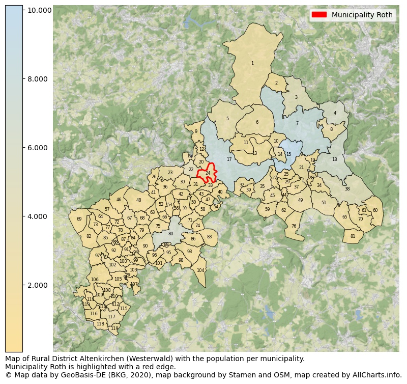
Map of Rural district Altenkirchen (Westerwald) with the population per municipality.Municipality Roth is highlighted with a red edge. The numbers at the map represent the following municipalities: 1: municipality Friesenhagen, 2: municipality Harbach, 3: municipality Niederfischbach, 4: municipality Mudersbach, 5: municipality Birken-Honigsessen ...Show more... Map of Rural district Altenkirchen (Westerwald) with the population per municipality.Municipality Roth is highlighted with a red edge. The numbers at the map represent the following municipalities: 1: municipality Friesenhagen, 2: municipality Harbach, 3: municipality Niederfischbach, 4: municipality Mudersbach, 5: municipality Birken-Honigsessen, 6: municipality Katzwinkel (Sieg), 7: municipality city Kirchen (Sieg), 8: municipality Brachbach, 9: municipality Forst, 10: municipality Wallmenroth, 11: municipality Hövels, 12: municipality Bitzen, 13: municipality Mittelhof, 14: municipality Scheuerfeld, 15: municipality city Betzdorf, 16: municipality Fürthen, 17: municipality city Wissen, 18: municipality city Herdorf, 19: municipality Grünebach, 20: municipality Etzbach, 21: municipality Alsdorf, 22: municipality Hamm (Sieg), 23: municipality Pracht, 24: municipality Roth, 25: municipality Steineroth, 26: municipality Niederirsen, 27: municipality Elben, 28: municipality Schutzbach, 29: municipality Molzhain, 30: municipality Breitscheidt, 31: municipality Seelbach bei Hamm (Sieg), 32: municipality Selbach (Sieg), 33: municipality Bruchertseifen, 34: municipality Niederdreisbach, 35: municipality Gebhardshain, 36: municipality Birkenbeul, 37: municipality Kausen, 38: municipality city Daaden, 39: municipality Fensdorf, 40: municipality Helmeroth, 41: municipality Ölsen, 42: municipality Hilgenroth, 43: municipality Racksen, 44: municipality Dickendorf, 45: municipality Steinebach/Sieg, 46: municipality Werkhausen, 47: municipality Isert, 48: municipality Oberirsen, 49: municipality Elkenroth, 50: municipality Volkerzen, 51: municipality Weitefeld, 52: municipality Heupelzen, 53: municipality Busenhausen, 54: municipality Idelberg, 55: municipality Obererbach (Westerwald), 56: municipality Bachenberg, 57: municipality Hasselbach, 58: municipality Eichelhardt, 59: municipality Malberg, 60: municipality Emmerzhausen, 61: municipality Mauden, 62: municipality Rosenheim (Landkreis Altenkirchen), 63: municipality Wölmersen, 64: municipality Rettersen, 65: municipality Friedewald, 66: municipality Kettenhausen, 67: municipality Weyerbusch, 68: municipality Birnbach, 69: municipality Kircheib, 70: municipality Derschen, 71: municipality Mammelzen, 72: municipality Forstmehren, 73: municipality Fiersbach, 74: municipality Sörth, 75: municipality Helmenzen, 76: municipality Nauroth, 77: municipality Ersfeld, 78: municipality Kraam, 79: municipality Hemmelzen, 80: municipality city Altenkirchen (Westerwald), 81: municipality Nisterberg, 82: municipality Hirz-Maulsbach, 83: municipality Ingelbach, 84: municipality Walterschen, 85: municipality Mehren, 86: municipality Michelbach (Westerwald), 87: municipality Giershausen, 88: municipality Ziegenhain, 89: municipality Almersbach, 90: municipality Neitersen, 91: municipality Schürdt, 92: municipality Orfgen, 93: municipality Gieleroth, 94: municipality Obernau, 95: municipality Fluterschen, 96: municipality Schöneberg, 97: municipality Kescheid, 98: municipality Oberwambach, 99: municipality Berzhausen, 100: municipality Reiferscheid, 101: municipality Stürzelbach, 102: municipality Flammersfeld, 103: municipality Seelbach (Westerwald), 104: municipality Berod bei Hachenburg, 105: municipality Eichen, 106: municipality Rott, 107: municipality Seifen, 108: municipality Oberlahr, 109: municipality Burglahr, 110: municipality Bürdenbach, 111: municipality Peterslahr, 112: municipality Güllesheim, 113: municipality Eulenberg, 114: municipality Niedersteinebach, 115: municipality Pleckhausen, 116: municipality Obersteinebach, 117: municipality Horhausen (Westerwald), 118: municipality Krunkel, 119: municipality Willroth ...Show less...
The number of rooms per house (dwelling)
The number of rooms of the houses in the municipality Roth
One moment please, your device is loading the charts...
Municipality Roth, 2019, number of rooms per house.
The percentage shows the relative share of houses per category based on the numer of rooms: 1 to 2 rooms, 3 to 4 rooms or 5 rooms or more. This is based on the total number of rooms as identified for all dwellings in the municipality Roth.
Data about more than 100 topics!
The table below shows data for more than 100 topics as most recently available for the municipality Roth. Select a category to display the related topics:
| Business | Value | Unit | Year |
|---|---|---|---|
| Businesses | no data | Number | 2015 |
| Active persons | no data | Number | 2015 |
| Gross wages | no data | Euro | 2015 |
| Dwellings | Value | Unit | Year |
|---|---|---|---|
| Houses 1 room | 6 | Number | 2019 |
| Houses 2 rooms | 19 | Number | 2019 |
| Houses 3 rooms | 73 | Number | 2019 |
| Houses 4 rooms | 126 | Number | 2019 |
| Houses 5 rooms | 203 | Number | 2019 |
| Houses 6 rooms | 120 | Number | 2019 |
| Houses 7+ rooms | 166 | Number | 2019 |
| Houses 1-2 rooms | 25 | Number | 2019 |
| Houses 3-4 rooms | 199 | Number | 2019 |
| Houses 5+ rooms | 489 | Number | 2019 |
| 1-2 rooms | 4% | Percentage | 2019 |
| 3-4 rooms | 28% | Percentage | 2019 |
| 5+ rooms | 69% | Percentage | 2019 |
| Elections | Value | Unit | Year |
|---|---|---|---|
| Voters Bundestag | 1111,00 | Number | 2017 |
| Voter turnout Bundestag | 63 | Number | 2017 |
| Votes valid Bundestag | 523 | Number | 2017 |
| Votes Bundestag CDU/CSU | 204 | Number | 2017 |
| Votes Bundestag SPD | 114 | Number | 2017 |
| Votes Bundestag GRÜNE | 15 | Number | 2017 |
| Votes Bundestag FDP | 40 | Number | 2017 |
| Votes Bundestag DIE LINKE | 40 | Number | 2017 |
| Votes Bundestag AfD | 102 | Number | 2017 |
| Votes Bundestag other parties | 8 | Number | 2017 |
| Votes Bundestag total | 523 | Number | 2017 |
| % Votes Bundestag CDU/CSU | 18% | Percentage | 2017 |
| % Votes Bundestag SPD | 10% | Percentage | 2017 |
| % Votes Bundestag GRÜNE | 1% | Percentage | 2017 |
| % Votes Bundestag FDP | 4% | Percentage | 2017 |
| % Votes Bundestag DIE LINKE | 4% | Percentage | 2017 |
| % Votes Bundestag AfD | 9% | Percentage | 2017 |
| % Votes Bundestag other parties | 1% | Percentage | 2017 |
| Employment | Value | Unit | Year |
|---|---|---|---|
| Employees | 544 | Number | 2019 |
| Employees male | 314 | Number | 2019 |
| Employees female | 230 | Number | 2019 |
| Employees foreigner | 32 | Number | 2019 |
| Employees male foreigner | 0 | Number | 2019 |
| Employees female foreigner | 0 | Number | 2019 |
| Unemployed | 50 | Number | 2018 |
| Unemployed foreigners | 4 | Number | 2018 |
| Unemployed severely disabled | 2 | Number | 2018 |
| Unemployed 15-20 | 1 | Number | 2018 |
| Unemployed 15-25 | 4 | Number | 2018 |
| Unemployed 55-65 | 12 | Number | 2018 |
| Unemployed long-term | 19 | Number | 2018 |
| % Unemployed | 3% | Percentage | 2018 |
| % Unemployed foreigners | 0% | Percentage of the population | 2018 |
| % Unemployed severely disabled | 0% | Percentage of the population | 2018 |
| % Unemployed 15-20 | 0% | Percentage of the population | 2018 |
| % Unemployed 15-25 | 0% | Percentage of the population | 2018 |
| % Unemployed 55-65 | 1% | Percentage of the population | 2018 |
| % Unemployed long-term | 1% | Percentage of the population | 2018 |
| Income | Value | Unit | Year |
|---|---|---|---|
| Income receivers | 644 | Number | 2015 |
| Income total | €18.810 | Euro | 2015 |
| Income tax | €2.500 | Euro | 2015 |
| Population | Value | Unit | Year |
|---|---|---|---|
| Population | 1.464 | Number | 2019 |
| Men | 738 | Number | 2019 |
| Women | 726 | Number | 2019 |
| % Men | 50% | Percentage | 2019 |
| % Women | 50% | Percentage | 2019 |
| 0-18 | 296 | Number | 2019 |
| 18-30 | 207 | Number | 2019 |
| 30-45 | 255 | Number | 2019 |
| 45-60 | 317 | Number | 2019 |
| 18-60 | 779 | Number | 2019 |
| 60-75 | 238 | Number | 2019 |
| 60+ | 389 | Number | 2019 |
| Average age | 43 | Average number | 2019 |
| Average age male | 41 | Average number | 2019 |
| Average age female | 45 | Average number | 2019 |
| Births | 16 | Number | 2018 |
| Births male | 8 | Number | 2018 |
| Births female | 8 | Number | 2018 |
| 1K Births | 11 | Number per 1000 inhabitants | 2018 |
| Deaths | 17 | Number | 2018 |
| Deaths male | 6 | Number | 2018 |
| Deaths female | 11 | Number | 2018 |
| 1K Deaths | 12 | Number | 2018 |
| 0-3 | 42 | Number | 2019 |
| Girls 0-3 | 19 | Number | 2019 |
| Boys 0-3 | 23 | Number | 2019 |
| 3-6 | 46 | Number | 2019 |
| Girls 3-6 | 22 | Number | 2019 |
| Boys 3-6 | 24 | Number | 2019 |
| 6-10 | 66 | Number | 2019 |
| 10-15 | 79 | Number | 2019 |
| 15-18 | 63 | Number | 2019 |
| 18-20 | 34 | Number | 2019 |
| 20-25 | 88 | Number | 2019 |
| 25-30 | 85 | Number | 2019 |
| 30-35 | 93 | Number | 2019 |
| 35-40 | 89 | Number | 2019 |
| 40-45 | 73 | Number | 2019 |
| 45-50 | 88 | Number | 2019 |
| 50-55 | 105 | Number | 2019 |
| 55-60 | 124 | Number | 2019 |
| 60-65 | 78 | Number | 2019 |
| 65-75 | 160 | Number | 2019 |
| Women 65-70 | 75 | Number | 2019 |
| Men 65-70 | 85 | Number | 2019 |
| 75+ | 151 | Number | 2019 |
| Women 75+ | 95 | Number | 2019 |
| Men 75+ | 56 | Number | 2019 |
| % 0-10 | 11% | Percentage | 2019 |
| % 10-18 | 10% | Percentage | 2019 |
| % 18-30 | 14% | Percentage | 2019 |
| % 30-45 | 17% | Percentage | 2019 |
| % 45-60 | 22% | Percentage | 2019 |
| % 60+ | 27% | Percentage | 2019 |
| Real estate | Value | Unit | Year |
|---|---|---|---|
| Property tax A revenue | €1.831 | Euro | 2018 |
| Property tax B revenue | €184.618 | Euro | 2018 |
| Trade tax actual revenue | €66.989 | Euro | 2018 |
| Property tax A basic amount | €458 | Euro | 2018 |
| Property tax B basic amount | €41.026 | Euro | 2018 |
| Trade tax basic amount | €15.950 | Euro | 2018 |
| Property tax A rate | €400 | Euro | 2018 |
| Property tax B rate | €450 | Euro | 2018 |
| Trade tax rate | €420 | Euro | 2018 |
| Real tax raising force | €259.458 | Euro | 2018 |
| Trade tax levy | €10.894 | Euro | 2018 |
| Trade tax net | €56.095 | Euro | 2018 |
| Community share in income tax | €464.236 | Euro | 2018 |
| Community share in sales tax | €22.866 | Euro | 2018 |
| Tax revenue | €735.666 | Euro | 2018 |
| Regional | Value | Unit | Year |
|---|---|---|---|
| Region code | 071325006096 | Code | 2019 |
| Region code 8 digits | 07132096 | Code | 07132096 |
| Sorting code | 071325006096 | Code | 071325006096 |
| Sorting code 8 digits | 07132096 | Code | 07132096 |
| Region name | Roth | Name | 2019 |
| Regional level | 6 | Categorical type | 2019 |
| Region type | Municipality | Categorical type | 2019 |
| Region type detail | municipality | Categorical type | 2019 |
| Region name with type | municipality Roth | Name | 2019 |
| Region name in German | Gemeinde Roth | Name | 2019 |
| Direct subregions | no data | Number | 2019 |
| NUTS code | DEB13 | Code | 2019 |
| Area | 4 | Area in km² | 2019 |
| Religion | Value | Unit | Year |
|---|---|---|---|
| Roman Catholic church | 609 | Number | 2011 |
| Protestant church | 363 | Number | 2011 |
| Other or none | 464 | Number | 2011 |
| % Roman Catholic church | 42% | Percentage | 2011 |
| % Protestant church | 25% | Percentage | 2011 |
| % Other or none | 32% | Percentage | 2011 |
| Roman Catholic church German | 600 | Number | 2011 |
| Protestant church German | 363 | Number | 2011 |
| Other or none German | 428 | Number | 2011 |
| % Roman Catholic church German | 43% | Percentage | 2011 |
| % Protestant church German | 26% | Percentage | 2011 |
| % Other or none German Foreign | 31% | Percentage | 2011 |
| Roman Catholic church Foreign | 9 | Number | 2011 |
| Protestant church Foreign | 0 | Number | 2011 |
| Other or none Foreign | 36 | Number | 2011 |
| % Roman Catholic church Foreign | 20% | Percentage | 2011 |
| % Protestant church Foreign | 0% | Percentage | 2011 |
| % Other or none Foreign | 80% | Percentage | 2011 |
Open data sources used
Data is used from multiple German open data providers. See this description of the sources with the definitions of all regional topics.
Sources & definitionsUnder development
Work is in progress to add more information to this page
This page will be further expanded with more topics in clear graphs. This will be done in several iterations in the coming weeks.