Population numbers per year
The number of inhabitants in the municipality Stockem
One moment please, your device is loading the charts...
Population numbers in the municipality Stockem for the years 2009 thru 2019.
The number of inhabitants is the number of persons as registered in the population register on January 1st.
Population at the map of Stockem
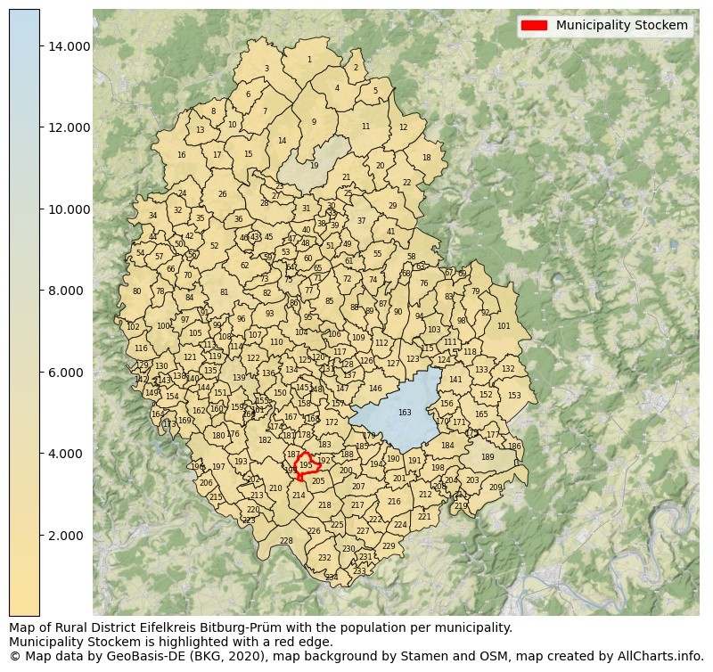
Map of Rural district Eifelkreis Bitburg-Prüm with the population per municipality.Municipality Stockem is highlighted with a red edge. The numbers at the map represent the following municipalities: 1: municipality Roth bei Prüm, 2: municipality Neuendorf, 3: municipality Auw bei Prüm, 4: municipality Olzheim, 5: municipality Kleinlangenfeld ...Show more... Map of Rural district Eifelkreis Bitburg-Prüm with the population per municipality.Municipality Stockem is highlighted with a red edge. The numbers at the map represent the following municipalities: 1: municipality Roth bei Prüm, 2: municipality Neuendorf, 3: municipality Auw bei Prüm, 4: municipality Olzheim, 5: municipality Kleinlangenfeld, 6: municipality Oberlascheid, 7: municipality Buchet, 8: municipality Mützenich, 9: municipality Gondenbrett, 10: municipality Bleialf, 11: municipality Weinsheim, 12: municipality Schwirzheim, 13: municipality Winterscheid, 14: municipality Sellerich, 15: municipality Brandscheid, 16: municipality Winterspelt, 17: municipality Großlangenfeld, 18: municipality Büdesheim, 19: municipality city Prüm, 20: municipality Fleringen, 21: municipality Rommersheim, 22: municipality Wallersheim, 23: municipality Watzerath, 24: municipality Heckhuscheid, 25: municipality Giesdorf, 26: municipality Habscheid, 27: municipality Pittenbach, 28: municipality Pronsfeld, 29: municipality Hersdorf, 30: municipality Oberlauch, 31: municipality Orlenbach, 32: municipality Großkampenberg, 33: municipality Niederlauch, 34: municipality Lützkampen, 35: municipality Kesfeld, 36: municipality Masthorn, 37: municipality Schönecken, 38: municipality Winringen, 39: municipality Dingdorf, 40: municipality Matzerath, 41: municipality Seiwerath, 42: municipality Leidenborn, 43: municipality Strickscheid, 44: municipality Harspelt, 45: municipality Lünebach, 46: municipality Euscheid, 47: municipality Lierfeld, 48: municipality Eilscheid, 49: municipality Nimsreuland, 50: municipality Herzfeld, 51: municipality Heisdorf, 52: municipality Üttfeld, 53: municipality Merlscheid, 54: municipality Sevenig (Our), 55: municipality Wawern, 56: municipality Sengerich, 57: municipality Roscheid, 58: municipality Burbach, 59: municipality Kinzenburg, 60: municipality Dackscheid, 61: municipality Lasel, 62: municipality Lichtenborn, 63: municipality Neuheilenbach, 64: municipality Pintesfeld, 65: municipality Lascheid, 66: municipality Eschfeld, 67: municipality Usch, 68: municipality Balesfeld, 69: municipality Zendscheid, 70: municipality Reiff, 71: municipality Hargarten, 72: municipality Feuerscheid, 73: municipality Manderscheid, 74: municipality Nimshuscheid, 75: municipality Waxweiler, 76: municipality Neidenbach, 77: municipality Lambertsberg, 78: municipality Reipeldingen, 79: municipality Steinborn, 80: municipality Dahnen, 81: municipality Arzfeld, 82: municipality Lauperath, 83: municipality Sankt Thomas, 84: municipality Irrhausen, 85: municipality Plütscheid, 86: municipality Niederpierscheid, 87: municipality Seffern, 88: municipality Heilenbach, 89: municipality Schleid, 90: municipality Sefferweich, 91: municipality Kickeshausen, 92: municipality Seinsfeld, 93: municipality Krautscheid, 94: municipality Malbergweich, 95: municipality Mauel, 96: municipality Heilbach, 97: municipality Olmscheid, 98: municipality Kyllburgweiler, 99: municipality Emmelbaum, 100: municipality Daleiden, 101: municipality Oberkail, 102: municipality Dasburg, 103: municipality Malberg, 104: municipality Oberpierscheid, 105: municipality Jucken, 106: municipality Oberweiler, 107: municipality Uppershausen, 108: municipality Ammeldingen bei Neuerburg, 109: municipality Ehlenz, 110: municipality Berkoth, 111: municipality city Kyllburg, 112: municipality Bickendorf, 113: municipality Zweifelscheid, 114: municipality Plascheid, 115: municipality Etteldorf, 116: municipality Preischeid, 117: municipality Niederweiler, 118: municipality Orsfeld, 119: municipality Leimbach, 120: municipality Echtershausen, 121: municipality Karlshausen, 122: municipality Scheuern, 123: municipality Fließem, 124: municipality Wilsecker, 125: municipality Altscheid, 126: municipality Ließem, 127: municipality Nattenheim, 128: municipality Biersdorf am See, 129: municipality Affler, 130: municipality Sevenig bei Neuerburg, 131: municipality Hamm, 132: municipality Gransdorf, 133: municipality Gindorf, 134: municipality Weidingen, 135: municipality Hütten, 136: municipality Fischbach-Oberraden, 137: municipality Wiersdorf, 138: municipality Scheitenkorb, 139: municipality city Neuerburg, 140: municipality Herbstmühle, 141: municipality Badem, 142: municipality Übereisenbach, 143: municipality Dauwelshausen, 144: municipality Koxhausen, 145: municipality Hütterscheid, 146: municipality Rittersdorf, 147: municipality Wißmannsdorf, 148: municipality Feilsdorf, 149: municipality Gemünd, 150: municipality Utscheid, 151: municipality Muxerath, 152: municipality Pickließem, 153: municipality Spangdahlem, 154: municipality Rodershausen, 155: municipality Niederraden, 156: municipality Metterich, 157: municipality Brecht, 158: municipality Baustert, 159: municipality Obergeckler, 160: municipality Nasingen, 161: municipality Sinspelt, 162: municipality Berscheid, 163: municipality city Bitburg, 164: municipality Keppeshausen, 165: municipality Dudeldorf, 166: municipality Niedergeckler, 167: municipality Brimingen, 168: municipality Mülbach, 169: municipality Bauler, 170: municipality Hüttingen an der Kyll, 171: municipality Gondorf, 172: municipality Oberweis, 173: municipality Waldhof-Falkenstein, 174: municipality Burg, 175: municipality Philippsheim, 176: municipality Lahr, 177: municipality Beilingen, 178: municipality Olsdorf, 179: municipality Birtlingen, 180: municipality Geichlingen, 181: municipality Niehl, 182: municipality Mettendorf, 183: municipality Bettingen, 184: municipality Röhl, 185: municipality Messerich, 186: municipality Herforst, 187: municipality Halsdorf, 188: municipality Ingendorf, 189: municipality city Speicher, 190: municipality Oberstedem, 191: municipality Scharfbillig, 192: municipality Wettlingen, 193: municipality Hüttingen bei Lahr, 194: municipality Niederstedem, 195: municipality Stockem, 196: municipality Roth an der Our, 197: municipality Körperich, 198: municipality Sülm, 199: municipality Enzen, 200: municipality Dockendorf, 201: municipality Eßlingen, 202: municipality Hommerdingen, 203: municipality Preist, 204: municipality Dahlem, 205: municipality Peffingen, 206: municipality Gentingen, 207: municipality Wolsfeld, 208: municipality Trimport, 209: municipality Orenhofen, 210: municipality Nusbaum, 211: municipality Auw an der Kyll, 212: municipality Idenheim, 213: municipality Kruchten, 214: municipality Schankweiler, 215: municipality Ammeldingen an der Our, 216: municipality Meckel, 217: municipality Alsdorf, 218: municipality Holsthum, 219: municipality Hosten, 220: municipality Biesdorf, 221: municipality Idesheim, 222: municipality Kaschenbach, 223: municipality Wallendorf, 224: municipality Gilzem, 225: municipality Prümzurlay, 226: municipality Ferschweiler, 227: municipality Niederweis, 228: municipality Bollendorf, 229: municipality Eisenach, 230: municipality Irrel, 231: municipality Menningen, 232: municipality Ernzen, 233: municipality Minden, 234: municipality Echternacherbrück ...Show less...
The number of rooms per house (dwelling)
The number of rooms of the houses in the municipality Stockem
One moment please, your device is loading the charts...
Municipality Stockem, 2019, number of rooms per house.
The percentage shows the relative share of houses per category based on the numer of rooms: 1 to 2 rooms, 3 to 4 rooms or 5 rooms or more. This is based on the total number of rooms as identified for all dwellings in the municipality Stockem.
Data about more than 100 topics!
The table below shows data for more than 100 topics as most recently available for the municipality Stockem. Select a category to display the related topics:
| Business | Value | Unit | Year |
|---|---|---|---|
| Businesses | no data | Number | 2015 |
| Active persons | no data | Number | 2015 |
| Gross wages | no data | Euro | 2015 |
| Dwellings | Value | Unit | Year |
|---|---|---|---|
| Houses 1 room | 0 | Number | 2019 |
| Houses 2 rooms | 1 | Number | 2019 |
| Houses 3 rooms | 0 | Number | 2019 |
| Houses 4 rooms | 4 | Number | 2019 |
| Houses 5 rooms | 2 | Number | 2019 |
| Houses 6 rooms | 11 | Number | 2019 |
| Houses 7+ rooms | 17 | Number | 2019 |
| Houses 1-2 rooms | 1 | Number | 2019 |
| Houses 3-4 rooms | 4 | Number | 2019 |
| Houses 5+ rooms | 30 | Number | 2019 |
| 1-2 rooms | 3% | Percentage | 2019 |
| 3-4 rooms | 11% | Percentage | 2019 |
| 5+ rooms | 86% | Percentage | 2019 |
| Elections | Value | Unit | Year |
|---|---|---|---|
| Voters Bundestag | 59,00 | Number | 2017 |
| Voter turnout Bundestag | 79 | Number | 2017 |
| Votes valid Bundestag | 36 | Number | 2017 |
| Votes Bundestag CDU/CSU | 10 | Number | 2017 |
| Votes Bundestag SPD | 17 | Number | 2017 |
| Votes Bundestag GRÜNE | 8 | Number | 2017 |
| Votes Bundestag FDP | 0 | Number | 2017 |
| Votes Bundestag DIE LINKE | 1 | Number | 2017 |
| Votes Bundestag AfD | 0 | Number | 2017 |
| Votes Bundestag other parties | 0 | Number | 2017 |
| Votes Bundestag total | 36 | Number | 2017 |
| % Votes Bundestag CDU/CSU | 17% | Percentage | 2017 |
| % Votes Bundestag SPD | 29% | Percentage | 2017 |
| % Votes Bundestag GRÜNE | 14% | Percentage | 2017 |
| % Votes Bundestag FDP | 0% | Percentage | 2017 |
| % Votes Bundestag DIE LINKE | 2% | Percentage | 2017 |
| % Votes Bundestag AfD | 0% | Percentage | 2017 |
| % Votes Bundestag other parties | 0% | Percentage | 2017 |
| Employment | Value | Unit | Year |
|---|---|---|---|
| Employees | 17 | Number | 2019 |
| Employees male | 0 | Number | 2019 |
| Employees female | 0 | Number | 2019 |
| Employees foreigner | 0 | Number | 2019 |
| Employees male foreigner | 0 | Number | 2019 |
| Employees female foreigner | 0 | Number | 2019 |
| Unemployed | no data | Number | 2016 |
| Unemployed foreigners | no data | Number | 2016 |
| Unemployed severely disabled | no data | Number | 2016 |
| Unemployed 15-20 | no data | Number | 2016 |
| Unemployed 15-25 | no data | Number | 2016 |
| Unemployed 55-65 | no data | Number | 2016 |
| Unemployed long-term | no data | Number | 2016 |
| % Unemployed | no data | Percentage | 2016 |
| % Unemployed foreigners | no data | Percentage of the population | 2016 |
| % Unemployed severely disabled | no data | Percentage of the population | 2016 |
| % Unemployed 15-20 | no data | Percentage of the population | 2016 |
| % Unemployed 15-25 | no data | Percentage of the population | 2016 |
| % Unemployed 55-65 | no data | Percentage of the population | 2016 |
| % Unemployed long-term | no data | Percentage of the population | 2016 |
| Income | Value | Unit | Year |
|---|---|---|---|
| Income receivers | 31 | Number | 2015 |
| Income total | €738 | Euro | 2015 |
| Income tax | €90 | Euro | 2015 |
| Population | Value | Unit | Year |
|---|---|---|---|
| Population | 87 | Number | 2019 |
| Men | 48 | Number | 2019 |
| Women | 39 | Number | 2019 |
| % Men | 55% | Percentage | 2019 |
| % Women | 45% | Percentage | 2019 |
| 0-18 | 16 | Number | 2019 |
| 18-30 | 7 | Number | 2019 |
| 30-45 | 14 | Number | 2019 |
| 45-60 | 26 | Number | 2019 |
| 18-60 | 47 | Number | 2019 |
| 60-75 | 12 | Number | 2019 |
| 60+ | 24 | Number | 2019 |
| Average age | 46 | Average number | 2019 |
| Average age male | 44 | Average number | 2019 |
| Average age female | 47 | Average number | 2019 |
| Births | 1 | Number | 2018 |
| Births male | 1 | Number | 2018 |
| Births female | 0 | Number | 2018 |
| 1K Births | 12 | Number per 1000 inhabitants | 2018 |
| Deaths | 1 | Number | 2018 |
| Deaths male | 0 | Number | 2018 |
| Deaths female | 1 | Number | 2018 |
| 1K Deaths | 12 | Number | 2018 |
| 0-3 | 1 | Number | 2019 |
| Girls 0-3 | 0 | Number | 2019 |
| Boys 0-3 | 1 | Number | 2019 |
| 3-6 | 4 | Number | 2019 |
| Girls 3-6 | 1 | Number | 2019 |
| Boys 3-6 | 3 | Number | 2019 |
| 6-10 | 5 | Number | 2019 |
| 10-15 | 4 | Number | 2019 |
| 15-18 | 2 | Number | 2019 |
| 18-20 | 2 | Number | 2019 |
| 20-25 | 2 | Number | 2019 |
| 25-30 | 3 | Number | 2019 |
| 30-35 | 7 | Number | 2019 |
| 35-40 | 4 | Number | 2019 |
| 40-45 | 3 | Number | 2019 |
| 45-50 | 3 | Number | 2019 |
| 50-55 | 14 | Number | 2019 |
| 55-60 | 9 | Number | 2019 |
| 60-65 | 5 | Number | 2019 |
| 65-75 | 7 | Number | 2019 |
| Women 65-70 | 4 | Number | 2019 |
| Men 65-70 | 3 | Number | 2019 |
| 75+ | 12 | Number | 2019 |
| Women 75+ | 5 | Number | 2019 |
| Men 75+ | 7 | Number | 2019 |
| % 0-10 | 11% | Percentage | 2019 |
| % 10-18 | 7% | Percentage | 2019 |
| % 18-30 | 8% | Percentage | 2019 |
| % 30-45 | 16% | Percentage | 2019 |
| % 45-60 | 30% | Percentage | 2019 |
| % 60+ | 28% | Percentage | 2019 |
| Real estate | Value | Unit | Year |
|---|---|---|---|
| Property tax A revenue | €5.351 | Euro | 2018 |
| Property tax B revenue | €5.214 | Euro | 2018 |
| Trade tax actual revenue | €299 | Euro | 2018 |
| Property tax A basic amount | €1.070 | Euro | 2018 |
| Property tax B basic amount | €1.043 | Euro | 2018 |
| Trade tax basic amount | €79 | Euro | 2018 |
| Property tax A rate | €500 | Euro | 2018 |
| Property tax B rate | €500 | Euro | 2018 |
| Trade tax rate | €380 | Euro | 2018 |
| Real tax raising force | €8.873 | Euro | 2018 |
| Trade tax levy | €54 | Euro | 2018 |
| Trade tax net | €245 | Euro | 2018 |
| Community share in income tax | €21.652 | Euro | 2018 |
| Community share in sales tax | €566 | Euro | 2018 |
| Tax revenue | €31.037 | Euro | 2018 |
| Regional | Value | Unit | Year |
|---|---|---|---|
| Region code | 072325008124 | Code | 2019 |
| Region code 8 digits | 07232124 | Code | 07232124 |
| Sorting code | 072325008124 | Code | 072325008124 |
| Sorting code 8 digits | 07232124 | Code | 07232124 |
| Region name | Stockem | Name | 2019 |
| Regional level | 6 | Categorical type | 2019 |
| Region type | Municipality | Categorical type | 2019 |
| Region type detail | municipality | Categorical type | 2019 |
| Region name with type | municipality Stockem | Name | 2019 |
| Region name in German | Gemeinde Stockem | Name | 2019 |
| Direct subregions | no data | Number | 2019 |
| NUTS code | DEB23 | Code | 2019 |
| Area | 4 | Area in km² | 2019 |
| Religion | Value | Unit | Year |
|---|---|---|---|
| Roman Catholic church | 83 | Number | 2011 |
| Protestant church | no data | Number | no data |
| Other or none | 6 | Number | 2011 |
| % Roman Catholic church | 94% | Percentage | 2011 |
| % Protestant church | no data | Percentage | no data |
| % Other or none | 7% | Percentage | 2011 |
| Roman Catholic church German | 83 | Number | 2011 |
| Protestant church German | no data | Number | no data |
| Other or none German | 6 | Number | 2011 |
| % Roman Catholic church German | 93% | Percentage | 2011 |
| % Protestant church German | no data | Percentage | no data |
| % Other or none German Foreign | 7% | Percentage | 2011 |
| Roman Catholic church Foreign | 0 | Number | 2011 |
| Protestant church Foreign | no data | Number | no data |
| Other or none Foreign | 0 | Number | 2011 |
| % Roman Catholic church Foreign | no data | Percentage | no data |
| % Protestant church Foreign | no data | Percentage | no data |
| % Other or none Foreign | no data | Percentage | no data |
Open data sources used
Data is used from multiple German open data providers. See this description of the sources with the definitions of all regional topics.
Sources & definitionsUnder development
Work is in progress to add more information to this page
This page will be further expanded with more topics in clear graphs. This will be done in several iterations in the coming weeks.