Population numbers per year
The number of inhabitants in the municipality Stuer
One moment please, your device is loading the charts...
Population numbers in the municipality Stuer for the years 2012 thru 2019.
The number of inhabitants is the number of persons as registered in the population register on January 1st.
Population at the map of Stuer
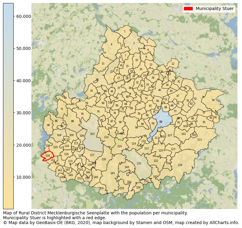
Map of Rural district Mecklenburgische Seenplatte with the population per municipality.Municipality Stuer is highlighted with a red edge. The numbers at the map represent the following municipalities: 1: municipality Nossendorf, 2: municipality Kletzin, 3: municipality city Demmin, 4: municipality city Dargun, 5: municipality Warrenzin ...Show more... Map of Rural district Mecklenburgische Seenplatte with the population per municipality.Municipality Stuer is highlighted with a red edge. The numbers at the map represent the following municipalities: 1: municipality Nossendorf, 2: municipality Kletzin, 3: municipality city Demmin, 4: municipality city Dargun, 5: municipality Warrenzin, 6: municipality Siedenbrünzow, 7: municipality Schönfeld, 8: municipality Utzedel, 9: municipality Verchen, 10: municipality Beggerow, 11: municipality city Neukalen, 12: municipality Bartow, 13: municipality Hohenmocker, 14: municipality Meesiger, 15: municipality Borrentin, 16: municipality Sarow, 17: municipality Sommersdorf, 18: municipality Breest, 19: municipality Hohenbollentin, 20: municipality Gnevkow, 21: municipality Golchen, 22: municipality Kummerow, 23: municipality Altenhagen, 24: municipality Lindenberg, 25: municipality Burow, 26: municipality Gültz, 27: municipality Grammentin, 28: municipality Kentzlin, 29: municipality city Malchin, 30: municipality Werder, 31: municipality Siedenbollentin, 32: municipality Kriesow, 33: municipality Tützpatz, 34: municipality Grapzow, 35: municipality Röckwitz, 36: municipality Pripsleben, 37: municipality city Stavenhagen, 38: municipality Ivenack, 39: municipality Beseritz, 40: municipality city Altentreptow, 41: municipality Basedow, 42: municipality Duckow, 43: municipality Grischow, 44: municipality Gülzow, 45: municipality Wolde, 46: municipality Gielow, 47: municipality Brunn, 48: municipality Ritzerow, 49: municipality Vollrathsruhe, 50: municipality Jürgenstorf, 51: municipality Wildberg, 52: municipality city Friedland, 53: municipality Neddemin, 54: municipality Galenbeck, 55: municipality Datzetal, 56: municipality Groß Teetzleben, 57: municipality Zettemin, 58: municipality Knorrendorf, 59: municipality Moltzow, 60: municipality Faulenrost, 61: municipality Staven, 62: municipality Genzkow, 63: municipality Klocksin, 64: municipality Briggow, 65: municipality Kittendorf, 66: municipality Neverin, 67: municipality Breesen, 68: municipality Trollenhagen, 69: municipality Rosenow, 70: municipality Woggersin, 71: municipality Hohen Wangelin, 72: municipality Bredenfelde, 73: municipality Neuenkirchen, 74: municipality Peenehagen, 75: municipality Zirzow, 76: municipality Varchentin, 77: municipality Schönbeck, 78: municipality Mölln, 79: municipality Grabowhöfe, 80: municipality Blankenhof, 81: municipality Schönhausen, 82: municipality Voigtsdorf, 83: municipality Sponholz, 84: municipality Kublank, 85: municipality Torgelow am See, 86: municipality Nossentiner Hütte, 87: municipality Groß Plasten, 88: municipality Jabel, 89: municipality city Neubrandenburg, 90: municipality Möllenhagen, 91: municipality Groß Miltzow, 92: municipality Pragsdorf, 93: municipality Wulkenzin, 94: municipality Kuckssee, 95: municipality Neetzka, 96: municipality Alt Schwerin, 97: municipality Cölpin, 98: municipality Silz, 99: municipality city Penzlin, 100: municipality Schloen-Dratow, 101: municipality Ankershagen, 102: municipality Lindetal, 103: municipality city Waren (Müritz), 104: municipality city Malchow, 105: municipality Petersdorf, 106: municipality Göhren-Lebbin, 107: municipality city Burg Stargard, 108: municipality Klink, 109: municipality Holldorf, 110: municipality Kargow, 111: municipality Groß Nemerow, 112: municipality Penkow, 113: municipality city Woldegk, 114: municipality Hohenzieritz, 115: municipality Sietow, 116: municipality Klein Vielen, 117: municipality Zislow, 118: municipality Walow, 119: municipality Kratzeburg, 120: municipality Fünfseen, 121: municipality Gotthun, 122: municipality Blumenholz, 123: municipality Möllenbeck, 124: municipality Groß Kelle, 125: municipality Blankensee, 126: municipality Leizen, 127: municipality Ludorf, 128: municipality Stuer, 129: municipality city Röbel/Müritz, 130: municipality Rechlin, 131: municipality Altenhof, 132: municipality Carpin, 133: municipality Bütow, 134: municipality Grünow, 135: municipality city Neustrelitz, 136: municipality Fincken, 137: municipality Bollewick, 138: municipality Vipperow, 139: municipality Feldberger Seenlandschaft, 140: municipality Userin, 141: municipality Melz, 142: municipality Zepkow, 143: municipality Massow, 144: municipality Priborn, 145: municipality city Mirow, 146: municipality Wredenhagen, 147: municipality Wokuhl-Dabelow, 148: municipality Lärz, 149: municipality Grabow-Below, 150: municipality Buchholz, 151: municipality Kieve, 152: municipality Godendorf, 153: municipality city Wesenberg, 154: municipality Priepert, 155: municipality Wustrow, 156: municipality Schwarz ...Show less...
The number of rooms per house (dwelling)
The number of rooms of the houses in the municipality Stuer
One moment please, your device is loading the charts...
Municipality Stuer, 2019, number of rooms per house.
The percentage shows the relative share of houses per category based on the numer of rooms: 1 to 2 rooms, 3 to 4 rooms or 5 rooms or more. This is based on the total number of rooms as identified for all dwellings in the municipality Stuer.
Data about more than 100 topics!
The table below shows data for more than 100 topics as most recently available for the municipality Stuer. Select a category to display the related topics:
| Business | Value | Unit | Year |
|---|---|---|---|
| Businesses | no data | Number | 2015 |
| Active persons | no data | Number | 2015 |
| Gross wages | no data | Euro | 2015 |
| Dwellings | Value | Unit | Year |
|---|---|---|---|
| Houses 1 room | 5 | Number | 2019 |
| Houses 2 rooms | 7 | Number | 2019 |
| Houses 3 rooms | 36 | Number | 2019 |
| Houses 4 rooms | 51 | Number | 2019 |
| Houses 5 rooms | 23 | Number | 2019 |
| Houses 6 rooms | 18 | Number | 2019 |
| Houses 7+ rooms | 19 | Number | 2019 |
| Houses 1-2 rooms | 12 | Number | 2019 |
| Houses 3-4 rooms | 87 | Number | 2019 |
| Houses 5+ rooms | 60 | Number | 2019 |
| 1-2 rooms | 8% | Percentage | 2019 |
| 3-4 rooms | 55% | Percentage | 2019 |
| 5+ rooms | 38% | Percentage | 2019 |
| Elections | Value | Unit | Year |
|---|---|---|---|
| Voters Bundestag | 217,00 | Number | 2017 |
| Voter turnout Bundestag | 62 | Number | 2017 |
| Votes valid Bundestag | 130 | Number | 2017 |
| Votes Bundestag CDU/CSU | 51 | Number | 2017 |
| Votes Bundestag SPD | 14 | Number | 2017 |
| Votes Bundestag GRÜNE | 7 | Number | 2017 |
| Votes Bundestag FDP | 7 | Number | 2017 |
| Votes Bundestag DIE LINKE | 13 | Number | 2017 |
| Votes Bundestag AfD | 35 | Number | 2017 |
| Votes Bundestag other parties | 3 | Number | 2017 |
| Votes Bundestag total | 130 | Number | 2017 |
| % Votes Bundestag CDU/CSU | 24% | Percentage | 2017 |
| % Votes Bundestag SPD | 6% | Percentage | 2017 |
| % Votes Bundestag GRÜNE | 3% | Percentage | 2017 |
| % Votes Bundestag FDP | 3% | Percentage | 2017 |
| % Votes Bundestag DIE LINKE | 6% | Percentage | 2017 |
| % Votes Bundestag AfD | 16% | Percentage | 2017 |
| % Votes Bundestag other parties | 1% | Percentage | 2017 |
| Employment | Value | Unit | Year |
|---|---|---|---|
| Employees | 101 | Number | 2019 |
| Employees male | 57 | Number | 2019 |
| Employees female | 44 | Number | 2019 |
| Employees foreigner | 4 | Number | 2019 |
| Employees male foreigner | 0 | Number | 2019 |
| Employees female foreigner | 0 | Number | 2019 |
| Unemployed | 9 | Number | 2018 |
| Unemployed foreigners | 0 | Number | 2018 |
| Unemployed severely disabled | 2 | Number | 2018 |
| Unemployed 15-20 | 0 | Number | 2018 |
| Unemployed 15-25 | 0 | Number | 2018 |
| Unemployed 55-65 | 3 | Number | 2018 |
| Unemployed long-term | 6 | Number | 2018 |
| % Unemployed | 4% | Percentage | 2018 |
| % Unemployed foreigners | 0% | Percentage of the population | 2018 |
| % Unemployed severely disabled | 1% | Percentage of the population | 2018 |
| % Unemployed 15-20 | 0% | Percentage of the population | 2018 |
| % Unemployed 15-25 | 0% | Percentage of the population | 2018 |
| % Unemployed 55-65 | 1% | Percentage of the population | 2018 |
| % Unemployed long-term | 2% | Percentage of the population | 2018 |
| Income | Value | Unit | Year |
|---|---|---|---|
| Income receivers | 106 | Number | 2015 |
| Income total | €5.919 | Euro | 2015 |
| Income tax | €1.723 | Euro | 2015 |
| Population | Value | Unit | Year |
|---|---|---|---|
| Population | 242 | Number | 2019 |
| Men | 131 | Number | 2019 |
| Women | 111 | Number | 2019 |
| % Men | 54% | Percentage | 2019 |
| % Women | 46% | Percentage | 2019 |
| 0-18 | 24 | Number | 2019 |
| 18-30 | 13 | Number | 2019 |
| 30-45 | 36 | Number | 2019 |
| 45-60 | 77 | Number | 2019 |
| 18-60 | 126 | Number | 2019 |
| 60-75 | 67 | Number | 2019 |
| 60+ | 92 | Number | 2019 |
| Average age | 52 | Average number | 2019 |
| Average age male | 49 | Average number | 2019 |
| Average age female | 55 | Average number | 2019 |
| Births | 1 | Number | 2018 |
| Births male | 0 | Number | 2018 |
| Births female | 1 | Number | 2018 |
| 1K Births | 4 | Number per 1000 inhabitants | 2018 |
| Deaths | 2 | Number | 2018 |
| Deaths male | 2 | Number | 2018 |
| Deaths female | 0 | Number | 2018 |
| 1K Deaths | 8 | Number | 2018 |
| 0-3 | 1 | Number | 2019 |
| Girls 0-3 | 1 | Number | 2019 |
| Boys 0-3 | 0 | Number | 2019 |
| 3-6 | 4 | Number | 2019 |
| Girls 3-6 | 2 | Number | 2019 |
| Boys 3-6 | 2 | Number | 2019 |
| 6-10 | 6 | Number | 2019 |
| 10-15 | 8 | Number | 2019 |
| 15-18 | 5 | Number | 2019 |
| 18-20 | 1 | Number | 2019 |
| 20-25 | 6 | Number | 2019 |
| 25-30 | 6 | Number | 2019 |
| 30-35 | 9 | Number | 2019 |
| 35-40 | 14 | Number | 2019 |
| 40-45 | 13 | Number | 2019 |
| 45-50 | 21 | Number | 2019 |
| 50-55 | 22 | Number | 2019 |
| 55-60 | 34 | Number | 2019 |
| 60-65 | 27 | Number | 2019 |
| 65-75 | 40 | Number | 2019 |
| Women 65-70 | 17 | Number | 2019 |
| Men 65-70 | 23 | Number | 2019 |
| 75+ | 25 | Number | 2019 |
| Women 75+ | 18 | Number | 2019 |
| Men 75+ | 7 | Number | 2019 |
| % 0-10 | 5% | Percentage | 2019 |
| % 10-18 | 5% | Percentage | 2019 |
| % 18-30 | 5% | Percentage | 2019 |
| % 30-45 | 15% | Percentage | 2019 |
| % 45-60 | 32% | Percentage | 2019 |
| % 60+ | 38% | Percentage | 2019 |
| Real estate | Value | Unit | Year |
|---|---|---|---|
| Property tax A revenue | no data | Euro | no data |
| Property tax B revenue | no data | Euro | no data |
| Trade tax actual revenue | no data | Euro | no data |
| Property tax A basic amount | no data | Euro | no data |
| Property tax B basic amount | no data | Euro | no data |
| Trade tax basic amount | no data | Euro | no data |
| Property tax A rate | no data | Euro | no data |
| Property tax B rate | no data | Euro | no data |
| Trade tax rate | no data | Euro | no data |
| Real tax raising force | no data | Euro | no data |
| Trade tax levy | no data | Euro | no data |
| Trade tax net | no data | Euro | no data |
| Community share in income tax | no data | Euro | no data |
| Community share in sales tax | no data | Euro | no data |
| Tax revenue | no data | Euro | no data |
| Regional | Value | Unit | Year |
|---|---|---|---|
| Region code | 130715159143 | Code | 2019 |
| Region code 8 digits | 13071143 | Code | 13071143 |
| Sorting code | 130715159143 | Code | 130715159143 |
| Sorting code 8 digits | 13071143 | Code | 13071143 |
| Region name | Stuer | Name | 2019 |
| Regional level | 6 | Categorical type | 2019 |
| Region type | Municipality | Categorical type | 2019 |
| Region type detail | municipality | Categorical type | 2019 |
| Region name with type | municipality Stuer | Name | 2019 |
| Region name in German | Gemeinde Stuer | Name | 2019 |
| Direct subregions | no data | Number | 2019 |
| NUTS code | DE80J | Code | 2019 |
| Area | 22 | Area in km² | 2019 |
| Religion | Value | Unit | Year |
|---|---|---|---|
| Roman Catholic church | no data | Number | no data |
| Protestant church | no data | Number | no data |
| Other or none | no data | Number | no data |
| % Roman Catholic church | no data | Percentage | no data |
| % Protestant church | no data | Percentage | no data |
| % Other or none | no data | Percentage | no data |
| Roman Catholic church German | no data | Number | no data |
| Protestant church German | no data | Number | no data |
| Other or none German | no data | Number | no data |
| % Roman Catholic church German | no data | Percentage | no data |
| % Protestant church German | no data | Percentage | no data |
| % Other or none German Foreign | no data | Percentage | no data |
| Roman Catholic church Foreign | no data | Number | no data |
| Protestant church Foreign | no data | Number | no data |
| Other or none Foreign | no data | Number | no data |
| % Roman Catholic church Foreign | no data | Percentage | no data |
| % Protestant church Foreign | no data | Percentage | no data |
| % Other or none Foreign | no data | Percentage | no data |
Open data sources used
Data is used from multiple German open data providers. See this description of the sources with the definitions of all regional topics.
Sources & definitionsUnder development
Work is in progress to add more information to this page
This page will be further expanded with more topics in clear graphs. This will be done in several iterations in the coming weeks.