Population numbers per year
The number of inhabitants in the municipality Zarrendorf
One moment please, your device is loading the charts...
Population numbers in the municipality Zarrendorf for the years 2012 thru 2019.
The number of inhabitants is the number of persons as registered in the population register on January 1st.
Population at the map of Zarrendorf
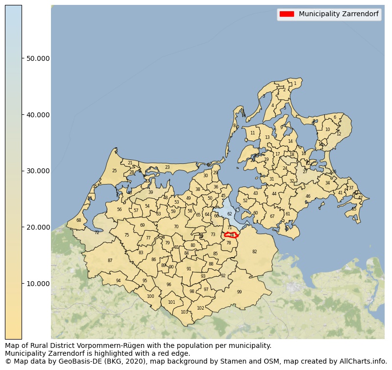
Map of Rural district Vorpommern-Rügen with the population per municipality.Municipality Zarrendorf is highlighted with a red edge. The numbers at the map represent the following municipalities: 1: municipality Putgarten, 2: municipality Altenkirchen, 3: municipality Dranske, 4: municipality Wiek, 5: municipality Breege ...Show more... Map of Rural district Vorpommern-Rügen with the population per municipality.Municipality Zarrendorf is highlighted with a red edge. The numbers at the map represent the following municipalities: 1: municipality Putgarten, 2: municipality Altenkirchen, 3: municipality Dranske, 4: municipality Wiek, 5: municipality Breege, 6: municipality Lohme, 7: municipality Glowe, 8: municipality Insel Hiddensee, 9: municipality Neuenkirchen, 10: municipality Sagard, 11: municipality Schaprode, 12: municipality city Sassnitz, 13: municipality Trent, 14: municipality Rappin, 15: municipality Lietzow, 16: municipality Ralswiek, 17: municipality Kluis, 18: municipality Patzig, 19: municipality Gingst, 20: municipality Ummanz, 21: municipality Prerow, 22: municipality Buschvitz, 23: municipality Zingst, 24: municipality Parchtitz, 25: municipality Born a. Darß, 26: municipality Binz, 27: municipality city Bergen auf Rügen, 28: municipality Wieck a. Darß, 29: municipality Klausdorf, 30: municipality Groß Mohrdorf, 31: municipality Dreschvitz, 32: municipality Sehlen, 33: municipality Pruchten, 34: municipality Zirkow, 35: municipality Ahrenshoop, 36: municipality Prohn, 37: municipality Sellin, 38: municipality Altenpleen, 39: municipality city Barth, 40: municipality Fuhlendorf, 41: municipality Lancken-Granitz, 42: municipality Baabe, 43: municipality Rambin, 44: municipality Samtens, 45: municipality Kramerhof, 46: municipality city Putbus, 47: municipality Göhren, 48: municipality Kenz-Küstrow, 49: municipality Neu Bartelshagen, 50: municipality Preetz, 51: municipality Wustrow, 52: municipality Altefähr, 53: municipality Groß Kordshagen, 54: municipality Divitz-Spoldershagen, 55: municipality Mönchgut, 56: municipality Saal, 57: municipality Lüdershagen, 58: municipality Kummerow, 59: municipality Karnin, 60: municipality Gustow, 61: municipality city Garz/Rügen, 62: municipality city Stralsund, 63: municipality Löbnitz, 64: municipality Pantelitz, 65: municipality Niepars, 66: municipality Lüssow, 67: municipality Poseritz, 68: municipality Dierhagen, 69: municipality Trinwillershagen, 70: municipality Velgast, 71: municipality Wendorf, 72: municipality city Ribnitz-Damgarten, 73: municipality Steinhagen, 74: municipality Zarrendorf, 75: municipality Ahrenshagen-Daskow, 76: municipality Jakobsdorf, 77: municipality Schlemmin, 78: municipality Elmenhorst, 79: municipality Weitenhagen, 80: municipality city Richtenberg, 81: municipality Millienhagen-Oebelitz, 82: municipality Sundhagen, 83: municipality Semlow, 84: municipality city Franzburg, 85: municipality Wittenhagen, 86: municipality Eixen, 87: municipality city Marlow, 88: municipality Papenhagen, 89: municipality Hugoldsdorf, 90: municipality Drechow, 91: municipality Gremersdorf-Buchholz, 92: municipality city Grimmen, 93: municipality Splietsdorf, 94: municipality Dettmannsdorf, 95: municipality city Bad Sülze, 96: municipality city Tribsees, 97: municipality Wendisch Baggendorf, 98: municipality Gransebieth, 99: municipality Süderholz, 100: municipality Lindholz, 101: municipality Deyelsdorf, 102: municipality Glewitz, 103: municipality Grammendorf ...Show less...
The number of rooms per house (dwelling)
The number of rooms of the houses in the municipality Zarrendorf
One moment please, your device is loading the charts...
Municipality Zarrendorf, 2019, number of rooms per house.
The percentage shows the relative share of houses per category based on the numer of rooms: 1 to 2 rooms, 3 to 4 rooms or 5 rooms or more. This is based on the total number of rooms as identified for all dwellings in the municipality Zarrendorf.
Data about more than 100 topics!
The table below shows data for more than 100 topics as most recently available for the municipality Zarrendorf. Select a category to display the related topics:
| Business | Value | Unit | Year |
|---|---|---|---|
| Businesses | no data | Number | 2015 |
| Active persons | no data | Number | 2015 |
| Gross wages | no data | Euro | 2015 |
| Dwellings | Value | Unit | Year |
|---|---|---|---|
| Houses 1 room | 2 | Number | 2019 |
| Houses 2 rooms | 10 | Number | 2019 |
| Houses 3 rooms | 62 | Number | 2019 |
| Houses 4 rooms | 114 | Number | 2019 |
| Houses 5 rooms | 155 | Number | 2019 |
| Houses 6 rooms | 84 | Number | 2019 |
| Houses 7+ rooms | 69 | Number | 2019 |
| Houses 1-2 rooms | 12 | Number | 2019 |
| Houses 3-4 rooms | 176 | Number | 2019 |
| Houses 5+ rooms | 308 | Number | 2019 |
| 1-2 rooms | 2% | Percentage | 2019 |
| 3-4 rooms | 35% | Percentage | 2019 |
| 5+ rooms | 62% | Percentage | 2019 |
| Elections | Value | Unit | Year |
|---|---|---|---|
| Voters Bundestag | 898,00 | Number | 2017 |
| Voter turnout Bundestag | 61 | Number | 2017 |
| Votes valid Bundestag | 533 | Number | 2017 |
| Votes Bundestag CDU/CSU | 172 | Number | 2017 |
| Votes Bundestag SPD | 54 | Number | 2017 |
| Votes Bundestag GRÜNE | 11 | Number | 2017 |
| Votes Bundestag FDP | 34 | Number | 2017 |
| Votes Bundestag DIE LINKE | 83 | Number | 2017 |
| Votes Bundestag AfD | 148 | Number | 2017 |
| Votes Bundestag other parties | 31 | Number | 2017 |
| Votes Bundestag total | 533 | Number | 2017 |
| % Votes Bundestag CDU/CSU | 19% | Percentage | 2017 |
| % Votes Bundestag SPD | 6% | Percentage | 2017 |
| % Votes Bundestag GRÜNE | 1% | Percentage | 2017 |
| % Votes Bundestag FDP | 4% | Percentage | 2017 |
| % Votes Bundestag DIE LINKE | 9% | Percentage | 2017 |
| % Votes Bundestag AfD | 16% | Percentage | 2017 |
| % Votes Bundestag other parties | 3% | Percentage | 2017 |
| Employment | Value | Unit | Year |
|---|---|---|---|
| Employees | 458 | Number | 2019 |
| Employees male | 219 | Number | 2019 |
| Employees female | 239 | Number | 2019 |
| Employees foreigner | 0 | Number | 2019 |
| Employees male foreigner | 0 | Number | 2019 |
| Employees female foreigner | 0 | Number | 2019 |
| Unemployed | 28 | Number | 2018 |
| Unemployed foreigners | 0 | Number | 2018 |
| Unemployed severely disabled | 4 | Number | 2018 |
| Unemployed 15-20 | 1 | Number | 2018 |
| Unemployed 15-25 | 1 | Number | 2018 |
| Unemployed 55-65 | 11 | Number | 2018 |
| Unemployed long-term | 8 | Number | 2018 |
| % Unemployed | 3% | Percentage | 2018 |
| % Unemployed foreigners | 0% | Percentage of the population | 2018 |
| % Unemployed severely disabled | 0% | Percentage of the population | 2018 |
| % Unemployed 15-20 | 0% | Percentage of the population | 2018 |
| % Unemployed 15-25 | 0% | Percentage of the population | 2018 |
| % Unemployed 55-65 | 1% | Percentage of the population | 2018 |
| % Unemployed long-term | 1% | Percentage of the population | 2018 |
| Income | Value | Unit | Year |
|---|---|---|---|
| Income receivers | 455 | Number | 2015 |
| Income total | €16.626 | Euro | 2015 |
| Income tax | €2.512 | Euro | 2015 |
| Population | Value | Unit | Year |
|---|---|---|---|
| Population | 1.106 | Number | 2019 |
| Men | 576 | Number | 2019 |
| Women | 530 | Number | 2019 |
| % Men | 52% | Percentage | 2019 |
| % Women | 48% | Percentage | 2019 |
| 0-18 | 194 | Number | 2019 |
| 18-30 | 74 | Number | 2019 |
| 30-45 | 206 | Number | 2019 |
| 45-60 | 306 | Number | 2019 |
| 18-60 | 586 | Number | 2019 |
| 60-75 | 242 | Number | 2019 |
| 60+ | 326 | Number | 2019 |
| Average age | 45 | Average number | 2019 |
| Average age male | 44 | Average number | 2019 |
| Average age female | 47 | Average number | 2019 |
| Births | 16 | Number | 2018 |
| Births male | 8 | Number | 2018 |
| Births female | 8 | Number | 2018 |
| 1K Births | 14 | Number per 1000 inhabitants | 2018 |
| Deaths | 5 | Number | 2018 |
| Deaths male | 3 | Number | 2018 |
| Deaths female | 2 | Number | 2018 |
| 1K Deaths | 5 | Number | 2018 |
| 0-3 | 40 | Number | 2019 |
| Girls 0-3 | 16 | Number | 2019 |
| Boys 0-3 | 24 | Number | 2019 |
| 3-6 | 35 | Number | 2019 |
| Girls 3-6 | 16 | Number | 2019 |
| Boys 3-6 | 19 | Number | 2019 |
| 6-10 | 44 | Number | 2019 |
| 10-15 | 42 | Number | 2019 |
| 15-18 | 33 | Number | 2019 |
| 18-20 | 15 | Number | 2019 |
| 20-25 | 25 | Number | 2019 |
| 25-30 | 34 | Number | 2019 |
| 30-35 | 84 | Number | 2019 |
| 35-40 | 66 | Number | 2019 |
| 40-45 | 56 | Number | 2019 |
| 45-50 | 73 | Number | 2019 |
| 50-55 | 113 | Number | 2019 |
| 55-60 | 120 | Number | 2019 |
| 60-65 | 111 | Number | 2019 |
| 65-75 | 131 | Number | 2019 |
| Women 65-70 | 62 | Number | 2019 |
| Men 65-70 | 69 | Number | 2019 |
| 75+ | 84 | Number | 2019 |
| Women 75+ | 47 | Number | 2019 |
| Men 75+ | 37 | Number | 2019 |
| % 0-10 | 11% | Percentage | 2019 |
| % 10-18 | 7% | Percentage | 2019 |
| % 18-30 | 7% | Percentage | 2019 |
| % 30-45 | 19% | Percentage | 2019 |
| % 45-60 | 28% | Percentage | 2019 |
| % 60+ | 29% | Percentage | 2019 |
| Real estate | Value | Unit | Year |
|---|---|---|---|
| Property tax A revenue | no data | Euro | no data |
| Property tax B revenue | no data | Euro | no data |
| Trade tax actual revenue | no data | Euro | no data |
| Property tax A basic amount | no data | Euro | no data |
| Property tax B basic amount | no data | Euro | no data |
| Trade tax basic amount | no data | Euro | no data |
| Property tax A rate | no data | Euro | no data |
| Property tax B rate | no data | Euro | no data |
| Trade tax rate | no data | Euro | no data |
| Real tax raising force | no data | Euro | no data |
| Trade tax levy | no data | Euro | no data |
| Trade tax net | no data | Euro | no data |
| Community share in income tax | no data | Euro | no data |
| Community share in sales tax | no data | Euro | no data |
| Tax revenue | no data | Euro | no data |
| Regional | Value | Unit | Year |
|---|---|---|---|
| Region code | 130735358104 | Code | 2019 |
| Region code 8 digits | 13073104 | Code | 13073104 |
| Sorting code | 130735358104 | Code | 130735358104 |
| Sorting code 8 digits | 13073104 | Code | 13073104 |
| Region name | Zarrendorf | Name | 2019 |
| Regional level | 6 | Categorical type | 2019 |
| Region type | Municipality | Categorical type | 2019 |
| Region type detail | municipality | Categorical type | 2019 |
| Region name with type | municipality Zarrendorf | Name | 2019 |
| Region name in German | Gemeinde Zarrendorf | Name | 2019 |
| Direct subregions | no data | Number | 2019 |
| NUTS code | DE80L | Code | 2019 |
| Area | 5 | Area in km² | 2019 |
| Religion | Value | Unit | Year |
|---|---|---|---|
| Roman Catholic church | no data | Number | no data |
| Protestant church | no data | Number | no data |
| Other or none | no data | Number | no data |
| % Roman Catholic church | no data | Percentage | no data |
| % Protestant church | no data | Percentage | no data |
| % Other or none | no data | Percentage | no data |
| Roman Catholic church German | no data | Number | no data |
| Protestant church German | no data | Number | no data |
| Other or none German | no data | Number | no data |
| % Roman Catholic church German | no data | Percentage | no data |
| % Protestant church German | no data | Percentage | no data |
| % Other or none German Foreign | no data | Percentage | no data |
| Roman Catholic church Foreign | no data | Number | no data |
| Protestant church Foreign | no data | Number | no data |
| Other or none Foreign | no data | Number | no data |
| % Roman Catholic church Foreign | no data | Percentage | no data |
| % Protestant church Foreign | no data | Percentage | no data |
| % Other or none Foreign | no data | Percentage | no data |
Open data sources used
Data is used from multiple German open data providers. See this description of the sources with the definitions of all regional topics.
Sources & definitionsUnder development
Work is in progress to add more information to this page
This page will be further expanded with more topics in clear graphs. This will be done in several iterations in the coming weeks.